Circumspectis uses the latest SOLIDWORKS 3D CAD solution in Unmanned Aerial Vehicle (UAV) technology to carry out land surveys. Founded by CAD engineer Christian Deas, the company works for a range of clients on environmental, agricultural and landscaping projects.
The Challenge
Having worked closely with farming professionals and utility firms, Christian spotted a gap in the market to improve the accuracy, cost and speed of landscape site surveys and inspections using the latest in UAV technology. Scanning the landscape with a drone, Christian needed a CAD software that could import scan data and convert it into CAD models that he could manipulate to deliver accurate site plans and construction drawings to client specifications.
“I use SOLIDWORKS to design containment systems for electricity sub stations and filtration systems to remove hydro-carbons from waste water. I was using DraftSight to capture site layouts for the drainage layouts but in 2D I wasn’t able to accurately show the lay of the land. Instead I would have to get a 2D plan from the utility power networks and use this to measure the fall of the ground or soak away depth,” says Christian. “If I could get a 3D topographical scan of the landscape into CAD it would give our customers a deeper insight into specific landscapes and make the design process a lot faster.”
SOLIDWORKS
Christian has been using SOLIDWORKS 3D CAD for engineering design projects since 2001.
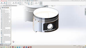
For Circumspectis, he needed a CAD package with specific tools including Finite Element Analysis, a CAD library Toolbox, Rendering and a Product Data Management system. Christian says after evaluating other CAD systems he found SOLIDWORKS Professional was the best in terms of its user-friendly interface, affordability and CAD functionality. He says:
“We work with lots of other companies and the majority all use SOLIDWORKS. One client in particular uses SOLIDWORKS PDM, so by having SOLIDWORKS Professional, I can integrate seamlessly into their processes and access their vault to transfer drawings and make design reviews.”
For his new droning venture, Christian uses SOLIDWORKS ScanTo3D solution, which reduces the time required to build complex 3D models of real-world items. By taking 3D scan data, such as point clouds and mesh, SOLIDWORKS ScanTo3D can quickly convert the information into 3D solids and surfaces.
“Traditionally, collecting landscape data is done via a Theodolite for surveying sites which can take many hours, even days to compile, depending on the acreage,” says Christian.
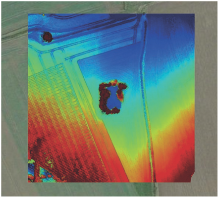
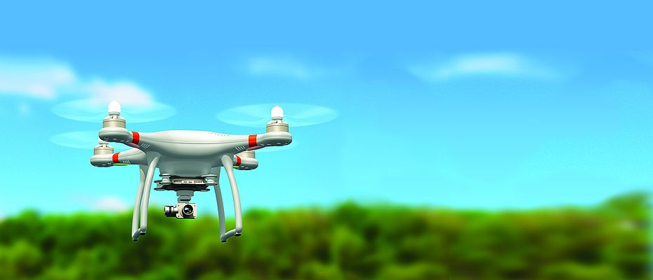
“It’s a lot quicker if you do it from the air. Using a DJI Phantom 3 Drone, I can map a site in 15 minutes with accuracy to the nearest cm. I can mark out the area, set the height, which the drone can fly at and work out a pre-set GPS flight plan. The drone does everything automatically and compiles hundreds of photos which can then be converted into accurate site plans.”
Using SOLIDWORKS ScanTo3D, Circumspectis can quickly import the scan data into 3D CAD and apply texture data to the mesh, refine imported mesh and use a Deviation Analysis tool to inspect for any deviations.
The Results
Being able to use Drone technology and 3D scan data in SOLIDWORKS with ScanTo3D, Circumspectis is able to offer UAV surveys as a real design solution. The company is now carrying out site surveys, building inspections and 3D topographical scanning and converting the data to use in 3D modelling.
“With the imported scan data, I can now see the contours of the ground and work out exactly where the steel spillages and filtrations systems need to go. I can quickly turn the scan into a mesh file and get a perfect 3D solid model, which we can pull, into an assembly. It makes designing for agricultural and civil engineering projects a lot easier and faster.”
“Without SOLIDWORKS I wouldn’t have a business. Everything we do at Circumspectis revolves around it. With SOLIDWORKS, we can quickly convert the 3D scan data into useable surface CAD models. It’s easy to use and our design processes are significantly faster, which means we can spend more time on innovation and discovering new design applications.”
New CAD Applications
Being able to manipulate drone data into accurate 3D models for design is now a real solution for architects, environmental agencies and civil engineers needing accurate site layouts. “Whether you are building a phone mast, telegraph pole, bridges or measuring land erosion, the potential is huge,” says Christian.
Drones are a cost-effective and risk-free way of inspecting buildings or areas that can be too dangerous to enter or access. We recently did a 3D scan near a beach by a cliff top and because each drone mission is set on GPS co-ordinates, we can fly the drone using the same flight data to compare scans over various periods of time to measure how much subsidence or coastal erosion there is.”
Circumspectis is also using the technology to map archaeological digs and importing the data into SOLIDWORKS to model ancient villages and show what they would have looked like to scale.
NT CADCAM
Christian adds:
“As a SOLIDWORKS reseller, NT CADCAM delivers. We are a small business and rely on a fast response if we need technical support. One of the biggest challenges to get Circumspectis up and running was to use the scan data for surface modelling. NT CADCAM was straight back to me with a solution. I couldn’t ask for a better service.”


