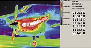
Every lamp post, telephone box and even manhole cover in the UK has a grid reference. And it’s this level Ordnance Survey detail that has allowed the Bedford-based thermal imaging specialist Thermascan to develop a ground breaking mobile, energy-loss detection system. It will be employed to scan many of the UK’s 24 million homes, 40% of which will be eligible to free or subsidised insulation. Based on a Flir SC620 thermal imaging camera, it determines whether the property needs loft or cavity wall insulation, or both, enabling an energy advisor to discuss the findings with the owner.
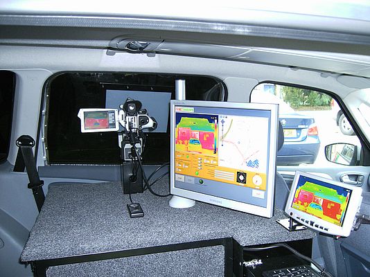
Working for the Energy Saving Partnership, Thermascan has designed the complete HeatSeekers concept. It comprises a specially adapted estate car that houses the navigation, thermal imaging and analysis systems. A fleet of these bespoke vehicles will soon be on the road, each with the ability to assess the insulation condition of more than 1,000 properties an hour. Operating at night and during the heating season, the multi-technology imaging system determines the address of each property and produces an energy efficiency verdict which is attached to a thermal image.
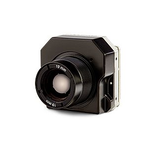
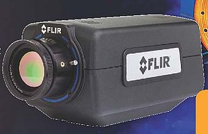
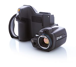
This cutting-edge system which is now the subject of patent registration naturally requires a high calibre thermal camera that is able to record images as the vehicle travels at between 10 – 15 mph. The Flir SC620 is a portable uncooled camera that is primarily designed for scientific applications. “Vital to this application is the camera’s Firewire digital output enabling us to conduct real-time analysis of the property images,” explained system designer, Dave Blain. “It also has a 640 x 480 detector that provides the high resolution we need to capture as much detail as possible.”
The Flir camera for the HeatSeeker application is fitted with a wide-angle lens. This is a purpose designed lens that is manufactured by FLIR to take full advantage of the high-resolution focal plane array sensor. It has an integral ultrasonic motor focussing mechanism, a facility commonly used by professional photographers. This enables the operator to employ either electronic or manual focussing to achieve the desired effect.
In operation, the HeatSeeker vehicle first receives details of the survey route via email. The highly sophisticated navigation system then comes into play. Unlike a car sat nav system that picks up its position from as few as two GPS satellites, the HeatSeeker system draws its information from sixteen. As a result it is accurate in its positioning to within a phenomenal 2 cm.
Several software systems are employed to provide the necessary intelligence to drive HeatSeeker. Satellite navigation and mapping information, Navteq and Ordnance Survey data work in tandem with the data acquisition software, Labview. The overall system was the product of twelve months development by Thermascan and test, measurement and automation specialists, Bytronic.
Once the location data has been received in the HeatSeeker vehicle the system automatically plots a survey route. All the software products are overlayed so that the Flir SC620 camera is activated by a grid reference and the energy loss data is embedded against the correct address details. “We can survey up to 5,000 properties in a single evening shift,” Dave Blain continues. “And at the end of it the system automatically categorises the results according to the insulation need.”
The HeatSeeker programme has already received wide acclaim and will be launched on mainland Europe later this year. It also has greater potential too. Dave Blain concluded, “As the thermal imaging system is designed to detect and document excessive heat loss, law enforcement authorities are also keen to use this technology.”


